
Rivers in North America
Posted By IsacThe North American continent lies entirely in the Northern and Western Hemisphere of the planet. Its northern border is surrounded by the Arctic Ocean while to its east and west lie the Atlantic and Pacific Oceans respectively. Within the continent, there are many important rivers which provide a supply of fresh water to its inhabitants. Mississippi River, Mackenzie River, and Rio Grande are some of the most popular names known all around the world.
Discussed below are ten popular rivers in North America.
Missouri River
The continent's longest river is the Missouri which runs from its source to its mouth for 3,767 kilometers. It emerges from the Rocky Mountains in the state of Montana. On the other hand, river's journey comes to an end at Spanish Lake in the Missouri State. It flows through seven states during its course.
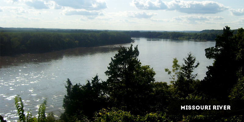
More informative facts about the Missouri River are given below.
- The joining of three rivers - Jefferson, Madison and Gallatin - forms the Missouri River near Three Forks which is a town in Montana.
- The huge river ranks fifteenth among the planet's longest rivers.
- The Missouri River was discovered by the Europeans in the seventeenth century.
- The Missouri drainage area is enormous and covers one-sixth of the land in the United States. This area equals 1,371,010 square kilometers.
- The huge Missouri basin accommodates a population of around ten million consisting of twenty-eight native tribes of North America, ten states of the US and some parts of Canada.
- Many man-made modifications, such as dams, have changed the natural flow of the river.
- A diverse species of fish is found in the river, including lake trout, channel catfish, carp, rainbows, sturgeon, Chinook salmon and many other varieties.
- Deep brush grasses and tall grasses are found along the banks of the river which house a population of formidable rattlesnakes.
- Individuals navigating across the river should look out for whirlpools as well strong currents.
Mississippi River
The second longest river flowing through North America is Mississippi. It is 3,374 kilometers long with a width of 11 kilometers at its widest point. Emerging from Lake Itasca in Minnesota, the river flows through nine other states of the US before reaching the end of its journey at the Gulf of Mexico. The Mississippi River is the major component of the continent's largest drainage system.
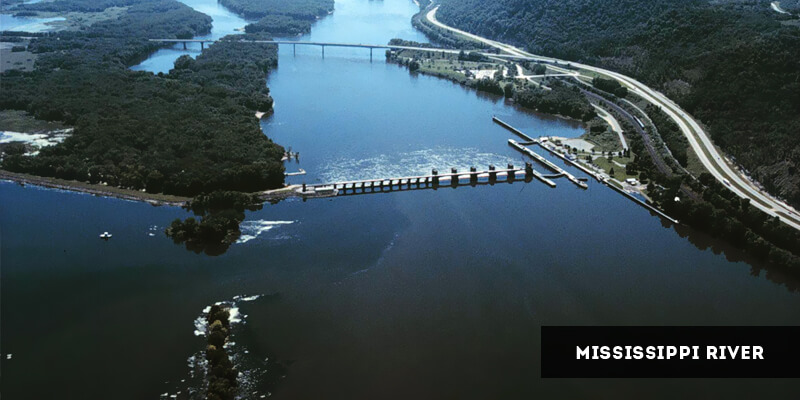
More information about this important North American river is provided in the following facts.
- Combined with the Missouri River, the Mississippi forms the continent's longest river system which ranks fourth in the world.
- The widest point of the Mississippi River is at Lake Winnibigoshish in the state of Minnesota.
- The river is narrowest at Lake Itasca where it stretches from twenty to thirty feet only.
- Martin Strel conquered the Mississippi River by swimming the entire length of the river in 2002, completing the task in sixty-eight days.
- The river's watershed extends from the Allegheny Mountains and continues up to the Rocky Mountains. During this course, the watershed covers thirty-one states of the US and two provinces of Canada, making it the world's fourth largest watershed.
- Mississippi offers a supply of fresh water and is also used for dumping domestic and industrial waste by the communities living along and around the river.
Ohio River
The importance of Ohio River lies in the fact that it is the largest tributary of the continent's second longest river - the Mississippi River. Emerging from Pennsylvania, the river flows through six states and covers a distance of 1,579 kilometers. It discharges an average of 7,957 cubic meters of water per second.
Here are some informative facts about the Ohio River.
- The river is formed when the Allegheny and Monongahela rivers join at Pittsburg. On the other hand, it reaches it mouth at the Mississippi River in the state of Illinois.
- The river supplies fresh drinking water to a population of more than 3 million individuals.
- The Ohio basin is home to more than 25 million souls which constitute around ten percent of the entire population of the United States. This basin spreads across an area of 490,601 square kilometers.
- Twenty dams have been built on the river for the purpose of power generation. However, this has resulted in polluting the river's water with silt and changing its natural flow.
Colorado River
The most important river flowing through the Southwestern region of the United States and northwestern Mexico is the Colorado River. It is 2,334 kilometers in length. It originates from the Rocky Mountains in Colorado which gives the river its name. On the other hand, its final destination is at the Gulf of California.
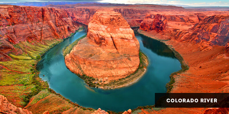
The following facts reveal more information about the Colorado River.
- During its course, the river covers seven states of the US and two states of Mexico.
- It is a source of fresh water to a large population of over twenty-five million individuals. In addition, it irrigates around 3.5 million acres of agricultural land.
- The Grand Canyon - one of the world's seven wonders - is found in the Colorado River.
- Before the construction of the Glen Canyon Dam, the water of the river used to appear red owing to the presence of silt particles. For this reason, the river was also known as the Red River. However, the silt is now trapped by the dam, restoring the natural color and clarity of the river's waters.
- The construction of dams on the river has affected the population of different fish species living in its waters. These dams have led to a change in the river's temperature from 80 F to 42 F, which is unsuitable for most of its fish to thrive.
Rio Grande
Rio Grande emerges from San Juan Mountains in Colorado and flows for 3,051 kilometers to reach its destination at the Gulf of Mexico. Part of the natural border between the USA and Mexico is formed by the river. It has been serving as an immensely significant source of water for irrigation as well as hydroelectric power generation.

More information about Rio Grande is discussed below.
- The river is also called Rio Bravo in Mexico.
- It is North America's fourth longest river system.
- Several major cities, including Santa Fe, Del Rio, El Paso and the Rio Grande City are situated along the river.
- Its basin area covers 471,900 square kilometers.
- Due to its historical importance, the river has been classified as one of the most important American Heritage Rivers.
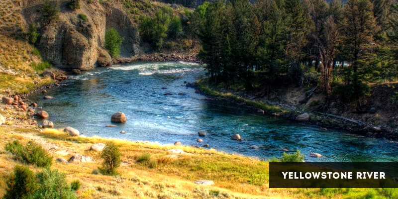
Yellowstone River
The Yellowstone River is one of the tributaries of the mighty Missouri River. It emerges from Absaroka Range in Wyoming where the North Fork converges with the South Fork. During its course, the river passes through three states of the US and covers a distance of 1,114 kilometers. The river is famous the world over owing to the breathtaking waterfalls which are one of its important natural features.
More information about the Yellowstone River is given through the following facts.
- It was known as the Elk River by the Native Americans.
- The Europeans first discovered the river in 1806.
- The river's basin covers 181,299 square kilometers of area.
- The average discharge of the Yellowstone River is quite low, being 390 cubic meters per second.
- In 2011, a huge oil spill polluted the waters of the river. It was caused by a burst in pipeline which released around forty-two thousand gallons of oils into the water.
Mackenzie River
The famous Mackenzie River constitutes Canada's longest river system. It emerges from the Great Slave Lake in Fort Providence and runs for 1,738 kilometers. After flowing through the Northwest Territories of Canada the river empties into the Arctic Ocean.
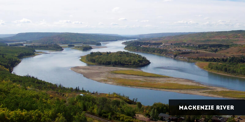
Here are some interesting facts about the Mackenzie River.
- It is the world's eleventh longest river.
- The river was named after a Scottish-Canadian discoverer - Alexandar Mackenzie - who travelled through the river during his journey towards the Pacific Ocean.
- The basin area of the Mackenzie is spread across 1,805,200 square kilometers. This enormous area is almost as large as the entire Mexico.
- The width of the river ranges between 1.6 and 3.2 kilometers while the points marked by islands are 4.8 to 6.4 kilometers wide.
- Interesting wildlife is found along the river's delta. Some of the most popular animals are the snow geese and the tundra swans.
- The river begins freezing in October and melts in May. During the rest of the months, the Mackenzie is navigable.
- The Mackenzie River system consists of important rivers including Peace, the Arctic Red, Slave and Liard Rivers.
- The Mackenzie basin consists of popular lakes including Lake Athabasca and the Great Bear Lake.
Columbia River
The largest river flowing through the Pacific Northwest part of the continent is the Columbia River. It emerges from British Columbia in Canada and empties into the Pacific Ocean after flowing for 2,000 kilometers. During its course, the Columbia River discharges an average of 7,500 cubic meters per second.
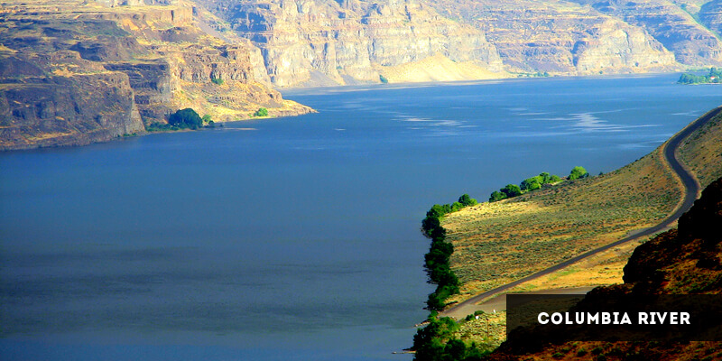
Here are some informative facts about the river.
- After leaving the British Columbia, the river flows into Washington DC, US. From there, it flows onwards and forms a natural border between the states of Washington and Oregon before arriving at its final destination in the Pacific Ocean. During this journey, the entire river covers around 260, 000 square miles.
- The Columbia River basin ranks fourth among the largest river basins on the planet. It covers an area of 668,000 square kilometers.
- The river serves as one of the world's biggest sources of hydroelectric power through a large number of dams built on the river.
- It is also popularly known as the River of the West, River Oregon as well as the Big River.
Green River
The Green River flows through the western part of the United States and serves as the main tributary of the Colorado River. It is 1,175 kilometers long and is one of the important rivers in North America. Originating from the Wind River Mountain Range of the Rocky Mountains, the river flows through three states - Wyoming, Utah and Colorado. It joins the Colorado River at the Canyonlands National Park located in the state of Utah.
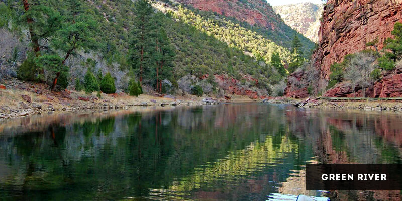
Go through the following informative facts about the Green River.
- The area drained by the Green River is 124,578 square kilometers.
- The average discharge of the river is quite low - only 173 cubic meters per second.
- The river is historically important as the river valley is where the Fremont Culture thrived during the 7th and 13th centuries.
- The Shoshone Indians called the river the Prairie Hen River.
Hudson River
The Hudson River is a small yet popular waterway flowing primarily through the New York State in the US. It originates from Adirondack Mountains and flows towards its mouth located at the Upper New York Bay. Its basin spreads across an area of 36,260 square kilometers. The river's average discharge is 620 cubic meters per second.
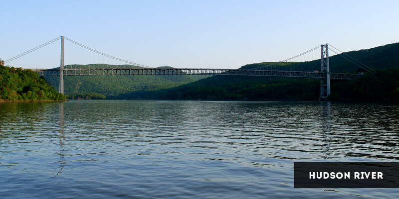
Here is some more information about the Hudson River.
- Although it was first discovered in the sixteenth century by Verrazano, the river is named after a European explorer, Henry Hudson. He explored the river a century later in 1609.
- The principal tributary of the river is known as the Mohawk River.
- The river is navigable. Ocean vessels can travel through it up to Albany while smaller vessels can travel up to Troy.
- The river's upper course is marked by waterfalls as well as rapids.
- The Catskill and Shawangunk Mountains mark the river's middle course.
The continent contains many more large as well as small waterways. Indeed, the rivers in North America areimmensely important for its economy and for sustaining its large population. These rivers offer fresh drinking water, serve as transport routes, generate hydroelectric power and offer irrigation water apart from being tourist attractions owing to their interesting geographical features.
North America Continent - Latest Articles

Top Universities in North America
Posted By MariaNorth America is home to a large number of world-famous universities. These prestigious...

Rivers in North America
Posted By IsacThe North American continent lies entirely in the Northern and Western Hemisphere of the...

Largest Countries in North America
Posted By IsacCovering an area of about 24,790,000 square kilometers, North America is the third largest...